About Us
PRECISION AND INNOVATION
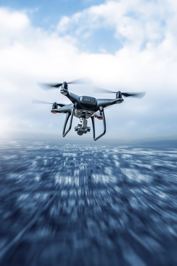
Who We Are
We combine cutting-edge drone technology with precision planning and expert execution to deliver actionable aerial data for construction, infrastructure, and residential projects. From initial mission design to high-resolution imagery, 3D modeling, and volumetric analysis, every step is tailored to your needs. Our certified pilots, advanced drones, and survey-grade data ensure accuracy, safety, and reliability — empowering architects, engineers, and project managers to make smarter decisions, streamline workflows, and achieve results efficiently.
WHY CHOOSE US
WHY CHOOSE US
We provide safe, precise, and reliable drone mapping services tailored to your project’s needs. From planning to data collection and analysis, our certified pilots and advanced technology deliver actionable insights that save time, reduce costs, and support confident decision-making.
Planning
Tailored flight paths and carefully designed mission frameworks ensure accuracy, compliance, and safety, setting the foundation for reliable data collection.
Quality
Survey-grade imagery, 3D models, thermal scans, and volumetric measurements processed into actionable insights for smarter project decisions.
Innovation
RTK-enabled drones, advanced sensors, and photogrammetry software transform aerial imagery into reliable, usable data for all stakeholders.
Turning Data into Decisions
Smart Planning, Tailored to Your Needs
Every successful drone mapping project starts with meticulous planning. We design each mission around your specific needs, combining certified and compliant operations, detailed site intelligence, and tailored flight plans to ensure accuracy and prioritize safety from the very first step. Before every flight, we review airspace classifications, secure Nav Canada authorizations, and evaluate weather, site hazards, and logistical requirements. Whether operating in controlled airspace, near urban areas, or sensitive environments, our integrated approach — including contingency planning — sets the stage for reliable and efficient data collection.
Precision Data Collection
Once planning is complete, our certified pilots execute the Collection phase with advanced RPAS technology and RTK-enabled drones, capturing high-resolution imagery and survey-grade data along optimized flight paths. We gather more than visuals, including orthomosaic imagery, 3D terrain models, thermal scans, and volumetric measurements, ensuring your project receives the most relevant and precise data. Every mission is monitored in real-time under Transport Canada regulations, delivering consistent, safe, and reliable results that form the foundation for the next phase of analysis.
Turning Data Into Insight
During the Analysis phase, raw aerial data is transformed into actionable intelligence. Using advanced photogrammetry, GIS, and 3D modeling software, we extract measurements, patterns, and insights that cannot be seen from the ground. Each dataset undergoes thorough validation against ground control points to meet survey-grade standards, allowing for volume calculations, structural assessments, land-use planning, and progress tracking. By converting millions of data points into clear, actionable insights, we empower stakeholders to make smarter, more confident decisions.
Process With Precision
After analysis, we refine and process the data into professional-grade deliverables that are practical and ready for integration into your workflows. Using advanced photogrammetry, GIS, and modeling platforms, we generate high-resolution orthomosaics, 3D point clouds, digital terrain models, and volumetric reports, all checked for accuracy and optimized for usability. From aligning imagery to filtering noise, we streamline complex datasets into clear, reliable tools that provide meaningful support for your project decisions.
Deliver With Impact
Finally, we deliver results in formats designed to fit your needs and the tools you already use. High-resolution orthomosaics, 3D models, and detailed reports integrate seamlessly with Autodesk Revit, SketchUp, AutoCAD, and GIS systems. Whether stakeholders require CAD drawings, BIM-compatible models, or visual reports for project managers and investors, we ensure the right data reaches the right people. By focusing on clarity, usability, and actionable insights, our deliverables transform aerial data into a powerful resource that drives informed decisions and project success.
Contact Drone Intel Solutions
Get in Touch
Whether you have questions, need a quote, or want more information about our services, we’re here to help.
Our Commitment
We provide reliable, high-quality drone solutions and support for every project.