Drone Inspections
Drone Inspections
Reliable Aerial Inspection Data
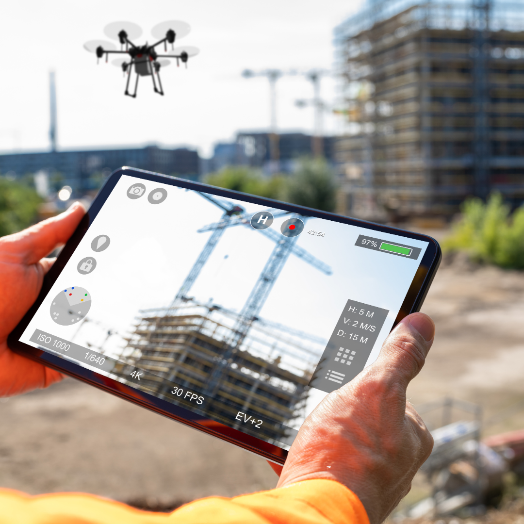
Drone technology is transforming the way inspections are performed — making them safer, faster, and more cost-effective than traditional methods. Instead of sending workers onto rooftops, scaffolding, or into confined spaces, drones provide high-resolution imagery and video that reveal even the smallest details from a safe distance. Using RTK-enabled drones, thermal cameras, and zoom optics, we can inspect everything from residential roofs to large-scale infrastructure with precision and reliability.
Key Benefits
Safety First
Reduce the need for workers to climb or enter hazardous areas, keeping inspections safe and efficient.
Cost & Time Savings
Cover large areas in a fraction of the time compared to manual inspections.
High Accuracy
Detect cracks, leaks, heat loss, and structural issues with centimeter-level precision.
Detailed Reporting
Deliver high-resolution images, annotated maps, and thermal scans that stakeholders can review anytime.
Inspection Data You Can Trust
Drone inspections provide stakeholders with a clear, unbiased record of site conditions. Whether for maintenance planning, warranty claims, insurance documentation, or safety compliance, the results provide defensible evidence and actionable insights.
For Residential Homeowners – Drone Roof & Home Inspections
Protect your home with fast, safe, and accurate inspections. Our drones capture high-resolution images and thermal scans to detect hidden issues like leaks, cracks, or heat loss — all without climbing onto your roof. Whether for insurance claims, warranty checks, or peace of mind, we provide a clear, unbiased record of your property’s condition.
For Commercial & Industrial Clients – Drone Infrastructure Inspections
Keep your assets safe and compliant with drone inspections. Using high-resolution cameras and thermal sensors, we detect structural issues, water intrusion, and energy inefficiencies across rooftops, solar panels, and industrial facilities. Covering buildings, bridges, powerlines, and towers, our inspections save time, reduce costs, and eliminate risk by keeping workers out of hazardous areas.
What to Expect in Your Results Package:
- High-Resolution Aerial Images: Clear, close-up photos from multiple angles highlighting areas of concern such as cracks, leaks, or damage.
- Thermal Imaging Report: Infrared scans revealing heat leaks, insulation failures, water intrusion, or hidden electrical issues.
- Annotated Maps & 3D Models: Orthomosaic maps and optional 3D models with problem areas marked for easy review by contractors, insurers, or engineers.
- Condition Assessment PDF: Stakeholder-ready report summarizing findings, complete with timestamped images, thermal overlays, and professional notes for insurance claims, compliance, or maintenance planning.
- Digital File Delivery: Convenient access to inspection results in formats optimized for sharing, review, and long-term documentation.
Disclaimer: Our drone measurements are highly accurate using RTK technology with centimeter-level precision. However, we are not licensed land surveyors, and our data is intended for reference and project management purposes only. For official boundary determinations or certified survey documentation, a licensed surveyor must be consulted.
That said, our deliverables are perfect for construction tracking, stockpile volumes, inspections, and stakeholder reporting, providing fast, reliable, and repeatable measurements that keep projects safe and on schedule.
Contact Drone Intel Solutions
Get in Touch
Whether you have questions, need a quote, or want more information about our services, we’re here to help.
Our Commitment
We provide reliable, high-quality drone solutions and support for every project.